
NewzVille International
Devastating floods in central Texas have claimed at least 119 lives, with over 160 people still missing. Search operations are on to trace the missing people by several agencies are working day in, day out.
NASA deployed two aircraft to assist state and local authorities in ongoing Texas Flooding recovery operations. Persistent cloud-cover has made it difficult to obtain clear satellite imagery, so the Disasters Program coordinated with NASA’s Airborne Science Program at NASA’s Johnson Space Flight Center in Houston to conduct a series of flights to gather observations of the impacted regions.
NASA is sharing these data directly with emergency response teams to inform their search and rescue efforts and aid decision-making and resource allocation.
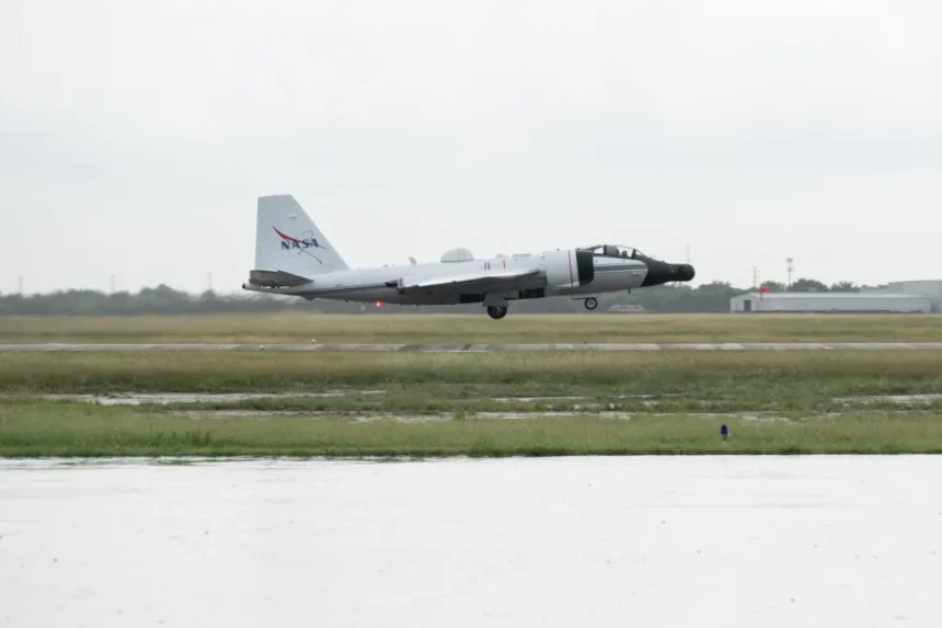
The high-altitude WB-57 aircraft operated by NASA Johnson departed from Ellington Field on July 8 to conduct aerial surveys. The aircraft is equipped with the DyNAMITE (Day/Night Airborne Motion Imager for Terrestrial Environments) sensor.
The DyNAMITE sensor views several miles of the surrounding area, providing high-resolution imagery critical to assessing damage and supporting coordination of ground-based recovery efforts. This system enables real-time collection and analysis of data, enhancing situational awareness and accelerating emergency response times.
In addition, the agency’s Uninhabited Aerial Vehicle Synthetic Aperture Radar UAVSAR is flying out of NASA’s Armstrong Flight Research Center in Edwards, California, aboard a Gulfstream III.
Managed by the agency’s Jet Propulsion Laboratory in Southern California, the UAVSAR team is planning to collect observations over the Guadalupe, San Gabriel, and Colorado river basins Wednesday, Thursday, and Friday.
Because UAVSAR can penetrate vegetation to spot water that optical sensors are unable to detect, the team’s goal is to characterize the extent of flooding to help with understanding the amount of damage within communities.
")

